Roosevelt BRT Road Diet Analysis
- Dec. 7, 2015
| Wednesday, December 9 6 – 8 PM TOPS School, Cafeteria 2500 Franklin Avenue E Seattle, WA | Thursday, December 10 6 – 8 PM UW Tower, Cafeteria North 4333 Brooklyn Avenue NE Seattle WA |
 Within 1/2 mile of the #RooseveltBRT corridor, 30% of surveyed households don't own a car. Compare this to 8% non-car ownership for the rest of Seattle.
 Where are all of those zero-car households? Here's a density map. Darker areas have > 10 car-free households per acre.
 High numbers of pedestrian & bike collisions within a 5-year period along the #RooseveltBRT corridor. Safety should be the #1 priority on #RooseveltBRT!
 657 total collisions between 2010 and 2015. Nearly 1/3rd (184) of those involved a person walking or biking.
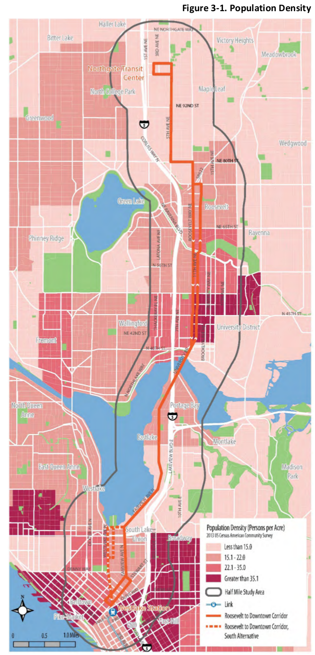 More than 13% of Seattle's population lives within 1/2 mile of the future #RooseveltBRT corridor. Due to density, this is a critically important corridor!
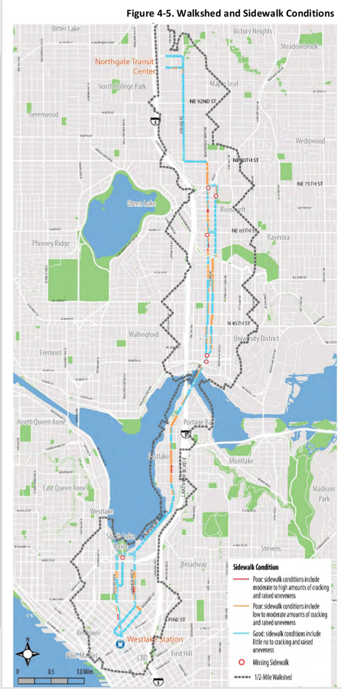 The worst sidewalks along #RooseveltBRT corridor are in South Lake Union, Eastlake, Roosevelt, & north U-District neighborhoods.
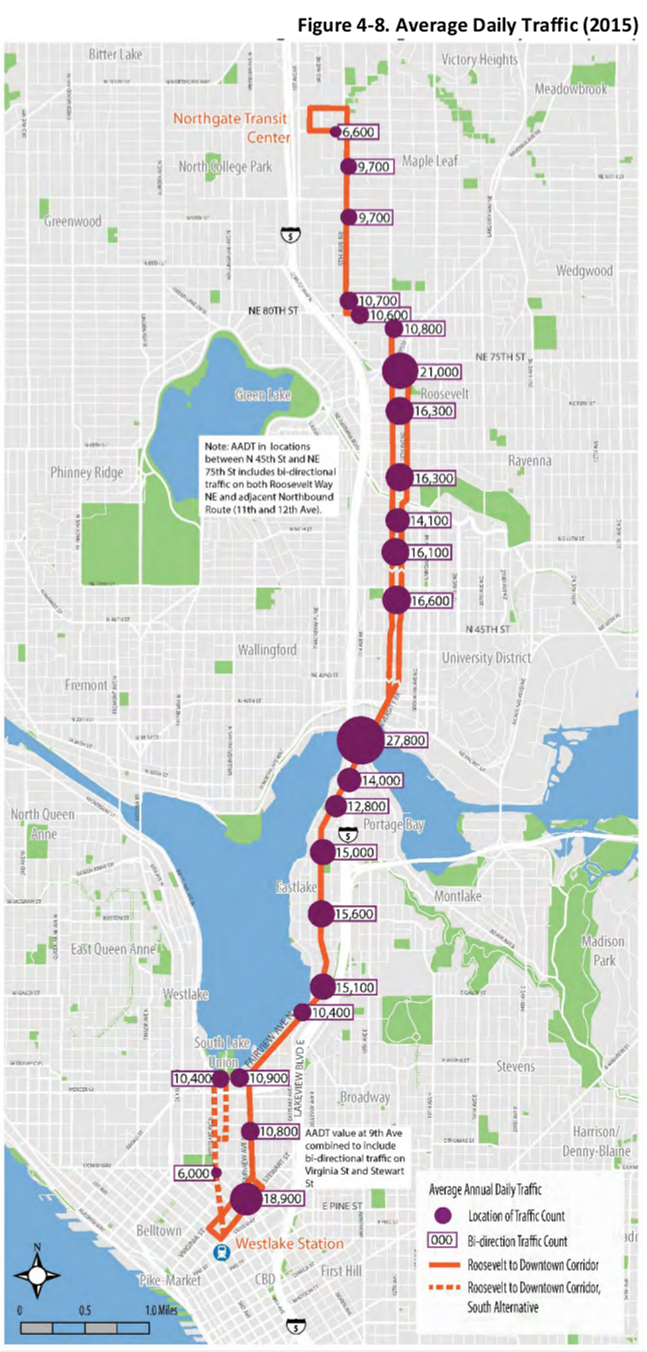 Vehicle counts for the corridor are pretty low. Remember, road rechannelizations are recommended for streets where vehicle volumes are under 20-25k per day.
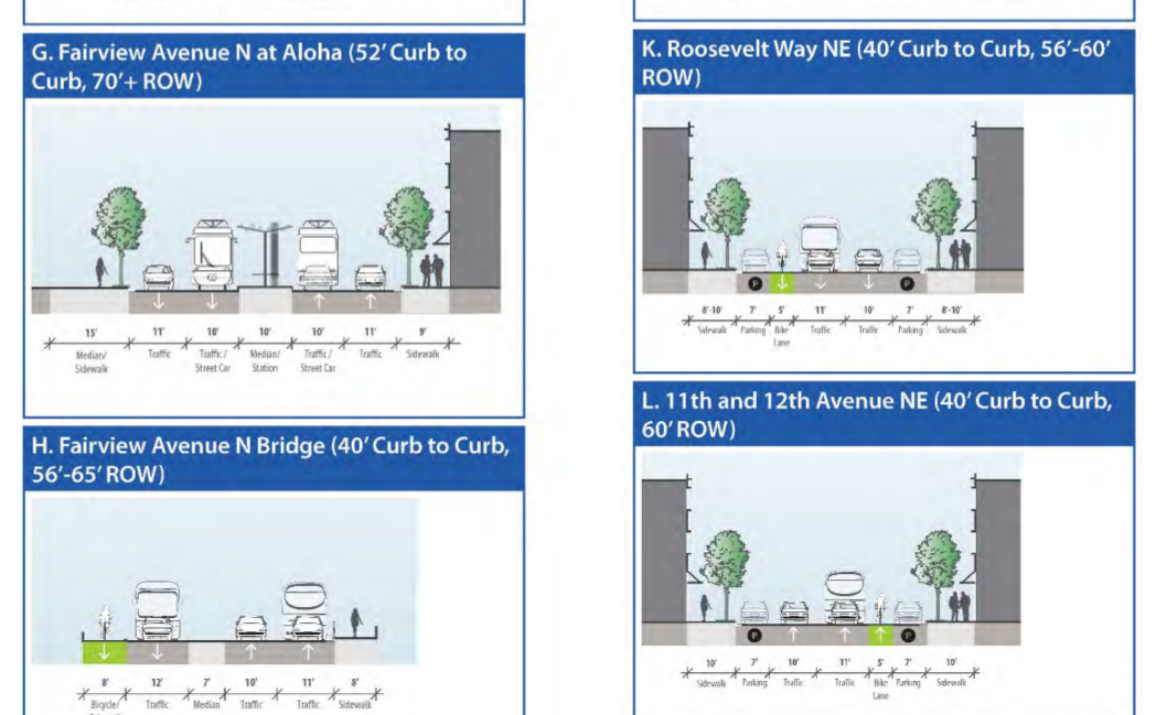 Much of #RooseveltBRT corridor has 4 lanes (two in each direction, including the Roosevelt/11th couplet), which can easily become 3 or 2 lanes w/out delaying drivers.
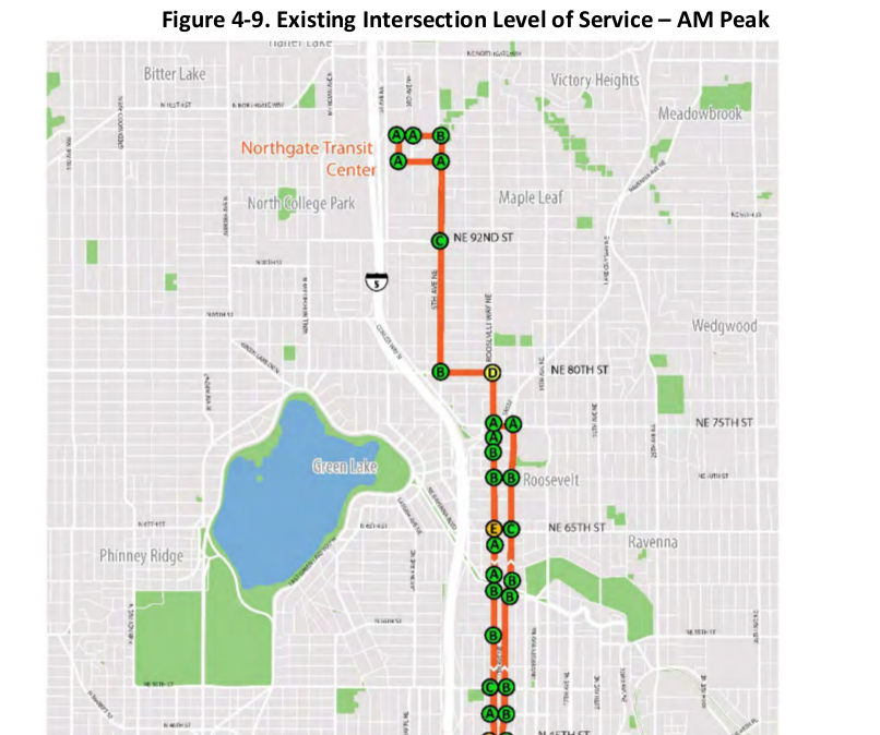 Meanwhile, @seattledot has devoted a whole section in the #RooseveltBRT study to corridor Level Of Service (LOS) and vehicle speeds. LOS is how traffic engineers measure congestion for cars. There's a completely separate section analyzing average speed for existing bus service, so the LOS section is entirely focused on car/truck movement. Worrying about congestion and speeds for cars should be our absolute lowest priority in trying to move people safely through this corridor.